

Hurricane Nolo Stalls Near Hawaii, Threatening Catastrophic Flooding
Source: X | @accuweather
EXECUTIVE SUMMARY
Hurricane Nolo stalled approximately 140 miles south of Hawaii Island on September 26 with maximum sustained winds near 105 miles per hour, triggering flash flood watches across the Big Island with rainfall projections up to 35 inches before the storm began a westward turn away from the island chain.
ANALYSIS
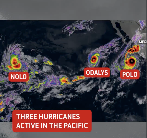
Hurricane Nolo tracked close to the Hawaiian Islands between September 24 and 26, 2026, before the National Hurricane Center noted a westward turn that would distance the storm from the main island chain. At its closest approach, Nolo was centered 140 to 145 miles south of South Point on Hawaii Island, operating as a Category 1 to Category 2 storm with maximum sustained winds near 105 miles per hour. Through most of the morning on September 26, the storm was nearly stationary. Stationary tropical systems accumulate rainfall over the same terrain for extended periods, which raises flash flood and debris flow risk well above what a faster-moving storm at the same intensity would produce.
The National Weather Service kept flash flood watches in effect across the Big Island as Nolo continued pushing rain bands inland despite its westward drift. Rainfall totals between 20 and 35 inches were projected for the most exposed terrain, with saturated volcanic slopes and steep interior drainages at elevated risk of debris flows, stream flooding, and road washouts. A hurricane watch posted for Hawaii Island was canceled once forecasters confirmed the storm's westward track made hurricane-force wind impacts on land unlikely.
Hawaii County emergency management activated evacuation shelters, staged search and rescue assets, and closed roads in areas most exposed to rapid stream rises. Governor Josh Green declared a state of emergency for Hawaii County ahead of the storm's peak influence. Shelters remained active on September 26, with water rescue resources deployed across coastal and interior communities.
Forecasters expected Nolo to strengthen into a major hurricane well south and southwest of Kauai by late Sunday night before clearing the main Hawaiian Islands early the following week. Flood-related hazards including elevated stream levels, saturated soils, and damaged road infrastructure were expected to persist after the storm passed. Nolo's four-day near-stationary track required full activation of search and rescue, shelter, and law enforcement coordination resources even without a direct landfall, a recurring pattern with slowly moving Pacific tropical systems that approach island terrain.
SOURCES
